 hiking stretch that, though interspersed with stays at campgrounds and holiday parks, hasn't given us access to the internet. since i'm running out of time on my current internet session, i'll post this in two parts.
tuesday, september 8
kerikeri to waitangi forest, 10.5 (+2) miles (the + numbers are miles that we walked that aren't on the trail - so extra miles to a campsite, places where we got lost, etc)
our packs felt especially heavy as we headed back on the trail, being recently loaded with a 6-day supply of food, but we pulled ourselves away from our cozy hostel with excitement about the miles ahead. the trail experience today was redeeming - the first 4 miles followed the kerikeri river down to rainbow falls and the stone store (historic missionary building), a track that reminded us of many of our recent experiences in our beloved minnesota state parks. it was almost exactly a year ago that we spent our first anniversary at wild river state park and walked a then-impressive 7 miles along the sunshine trail, one of a few trips
 (the white oak trail with chris and daniela was another) that contributed towards our decision to try the te araroa.
after a road-margin interruption through an affluent neighborhood, we delved into the waitangi forest and found our most satisfying campsite to date on a flat patch among the pine needles. also spotted our first wild pigs, little black things that we initially mistook for bear cubs, despite knowing that new zealand is completely bear-free.
wednesday, september 9
waitangi forest to paihia, 7.5 miles
we allowed ourselves a tourist day today, scheduling a stop at the waitangi treaty grounds, where the maori and british government signed an agreement in 1840 essentially making nz a british colony. the $20 entry fee was surprisingly steep, as it's been raised significantly in the last year since the grounds became free for nz citizens, but in the end we were glad that we lightened our wallets. this area was a site of heavy missionary activity during the early colonization period, and one of the things that struck us was that they are always spoken of as having a positive contribution, serving as mediators during an especially intense season of tribal warfare. good for them. :)
spent the night at a holiday camp (a campground that typically includes a variety of lodging options - tent sites, campervan sites, small cabin/motel-style rooms, campervans for rent) between paihia and opua on the beautiful bay of islands (a top destination for
 both tourists and vacationing kiwis), along a lovely stretch of the trail (the paihia-opua coastal walkway) that winds along the hills over the beach so as to be accessible even during high tide.
oh, i forgot to mention earlier - this morning on our way out of the forest we spoke with a forest management employee on a 4x4 who was loading dead possums into baskets on the front and back of his vehicle. there's such a possum problem throughout all of nz that they have poison traps all over to kill them off, and the guy we spoke to this morning said that he picked up 300 dead ones the day before. yet another example of non-native species wreaking havoc on the native environment.
jeremy, in response to your question - the only weta we've seen so far was in the auckland museum - blessed be the name of the Lord!
thursday, september 10
paihia to russell forest, 15 miles
while the day's walking ended with an hour-long uphill stretch that turned me into an ugly, tantrum-throwing child, it really did have some enjoyable sections. the rest
 of the paihia-opua walkway was as dramatic and beautiful as the first half, the $1 ferry across the veronica channel, though very brief, was plenty exciting for us footsore travelers, and the okiato-russell walkway culminated in a long stretch of quiet boardwalk among the mangroves. this is what we came to nz for. the post-lunch miles, however, had little to recommend them - just 10 miles along the side of the road to the start of the russell forest. the things you can see on the side of the road - today's trends included cassette tapes and cheesecloth (miles apart from each other), as if someone had a basket full of these items and flung them out of the windows of a passing car at regular intervals. there's also what appears to be an illegal dumping ground off of a steep cliff on a remote section of the road - if you look down, you'll see old cars, trunk freezers, strollers, and plenty more, nestled in-between the trees. we camped on a nice flat spot just barely inside the forest.
friday, september 11
russell forest to russell forest, 9 miles
in the optimism of early morning we'd hoped to tackle all 13 miles of the forest today, but as the afternoon wore on, it became apparent that this plan would not be possible. overall, the russell forest experience was positive. despite it having rained last night, there were few muddy patches, and the trail was mostly wide and well-marked. we began running into trouble at around 3 pm, when the track grew increasingly narrow, squeezing us tightly
 between green spiky bushes with yellow flowers (i have yet to find out what they're called) in a way that reminded me of sleeping beauty's prince hacking his way through the forest of thorns, though we had nowhere near as effective a weapon. around 4 pm, moments after we checked our position on the GPS and celebrated being within a half mile of the next junction, we encountered the result of a landslide that had obliterated the trail and made for some precarious traversing of obviously unstable territory. finally emerging on the other side, we discovered by the density of the bush that we hadn't actually made it back onto the path, and eventually gave up on an attempt to climb up to where we expected it to be. we soon came across a second landslide area, crossing this one without much difficulty but also without managing to position ourselves on the path again.
growing concerned about the amount of daylight remaining, when we came across the third landslide area we tried to scale the steep, raw hillside with the intent of bushwhacking across the summit to the other side of the hill, where we knew we could pick up the track again. this only succeeded in scaring us, as we couldn't get many solid hand- and footholds and the packs threw off our balance significantly, so we gave up and headed back to the lower levels of the slide area, right above the drop-off below. somehow, just when we were considering spending the night right there in the while bush, off the track, we stumbled across the trail and followed it to the next junction, where we set up shop under the protection of a cluster of trees. would rather not repeat this day again!
saturday, september 12
russell forest to kaiikanui forest, 14 miles (+1)
rained all through the night. rained all through the day. looks like it plans to rain all throughtonight as well. this is the kind of day that makes us long for the hot soup mixes in our packs (we usually gravitate away from cooking at night, since we just don't have the energy for it), but having to prepare it in such wet conditions is quite a deterrent. we stopped at a small dairy (shop w/ some groceries) at lunchtime and ate our meat pies & chips in the shelter of the adjacent burger shop's patio as the rain poured down especially violently. the burger place was, unfortunately, closed. thought seriously about getting off the trail and staying at a nearby motel, but the rain let up and we continued on. did 10 miles of road walking today, but the scenery (helena bay, teal bay, and plenty of farmland) was pretty and we didn't mind the walk.
upon arriving at the junction that marked 1.5 miles left to go, a DOC (department of conservation) sign advertised a campground with an arrow pointing down the road that we weren't planning to take, tempting us with the idea of toilets and flat campsites. it didn't, however, mention how far down the road it was, and we gave up after 3/4 of a mile without any sign of it (the GPS, though not always trustworthy, showed it to be a few miles in quite another direction). camped (illegally) in the forest instead. sometimes there just doesn't seem to be another option, given the surrounding areas. hopefully the te araroa trust will be able to address these problem spots, given some time.
pictures:
1-the rainbow of rainbow falls, on our way out of kerikeri
2-the perfect lunch spot, a high hill overlooking the old harbour in kerikeri
3-a boardwalk section on the paihia-opua coastal walkway
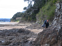
4-navigating a rocky spit on our way out of paihia
5-bryan refilling the water bottles at a stream in the russell forest. being particularly paranoid about the amount of water that we have, this has become his job. in the mornings, he even takes my camelbak out of my pack and fills it up with water from the extra bottles for convenience. what a nice guy!
part 2 to follow...
rachel


No comments:
Post a Comment